 |
| 2802' - Above it all~ |
A long time coming - how I'd missed being up here~ Our route to
Stimson Hill goes up Mt. Washington. With the heavy logging & truck traffic, it's been impossible to get even close during the week. It's fun to have a partner for this ride - since it's long & difficult.
Charlotte had the time - so we made a plan to meet at the MHC & just see how far we could get. It was a hazy, cool morning & as usual we were the only ones there. It was super to see Fancy again! The mares recognized each other & Farah was
So happy to have Fancy as her companion for the day!
 |
| The End of the Trail! |
We took the usual forested trail out, the one that has always gone past the quarry & still did my
last visit here in February. Before we'd even reached the spot where the trail turned to go by - the trail disappeared.
 |
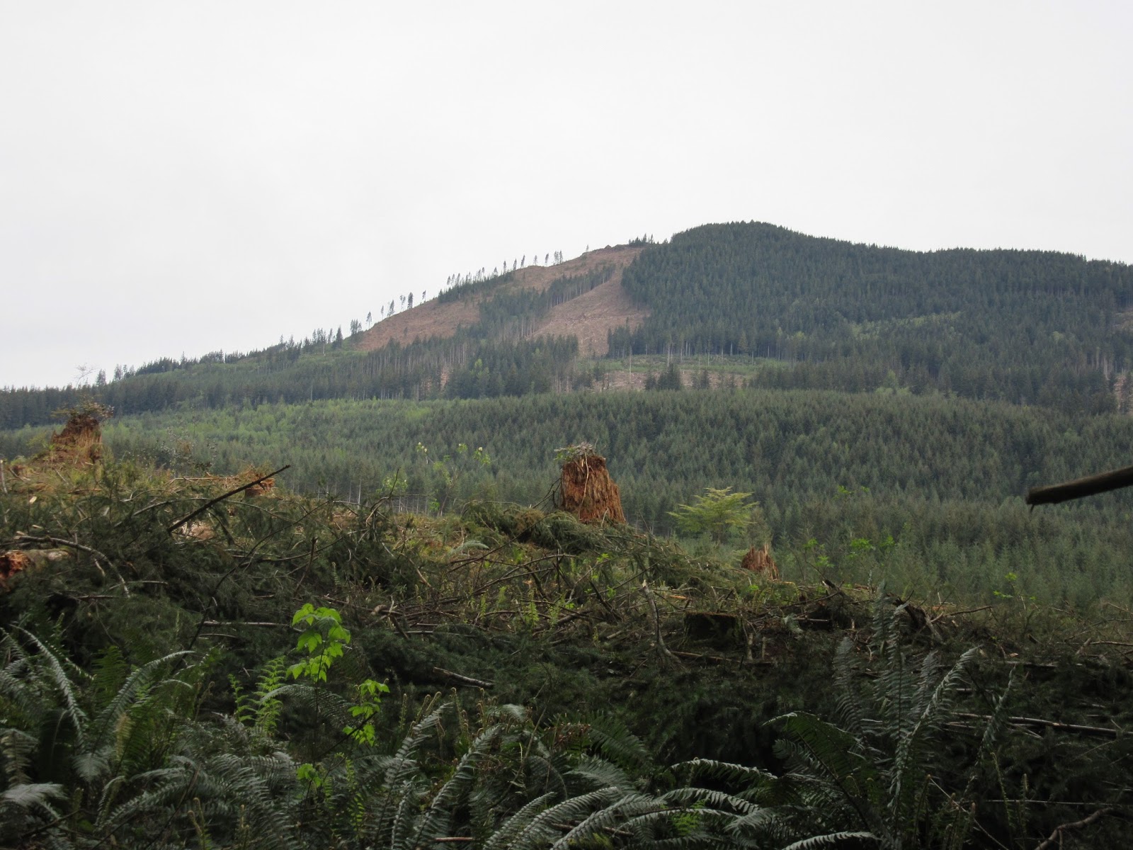
| Clear-cut & Mt. Washington |
Slash from the logging everywhere & deep in spots. No sign of where the trail had been.
 |
| New View of the Quarry |
We did some hunting - I got off & looked for a way around - we came out to a newly made & rocked road. Now, I knew we would be able to get out. The way around the end of the gate on the power line - is now treacherous, narrower than ever & getting soft - with a nasty drop off the edge if a hoof were to miss the footing :-( Past that!
 |
| On our Way! |
Gunfire alerted us to a group firing off high powered rifles - luckily at a shot block - which put the four of us on edge. Both mares just dug in - attacking the first levels of the climb with minimal effort.
 |
| Mt. Rainier on the Skyline~ |
We couldn't have picked a more perfect day, moderate temperature, light breeze & at least the haze wasn't so thick that we couldn't see Mt. Rainier.
 |
| Charlotte & Fancy - from Mt. Washington |
|
We took a short break after the first long, hard pull~
 |
| Connie & Farah, Mt. Pilchuck to the left~ |
I'd told Charlotte that I could find my way over to
Stimson & that was our goal, which put a lot more climbing ahead of us...
 |
| View south from Barbara's Bench~ |
Before long we reached just over 2,000 ft. at Barbara's Bench. We both had to climb up & get photos!
 |
| Toward the North with Victoria in the distance~ |
It's such a unique feeling - to be able to see over to where I ride so often & admire it's rise above the surrounding country. From this viewpoint - 500 ft. higher than the highest point there. We were still going, up & up. Soon coming to an intersection that gave us a choice of up or down.
 |
| From Stimson Hill - Whitehorse~ |
At ten-miles, we decided to go on another mile - then if there were no views, turn back. About half-way up this hard pull, here came two hikers with walking sticks. They stopped, raised the sticks over their heads - Farah instantly 180'ed :-) They explained that they'd hiked in off Cedarvale Loop. We went for the views! I did this
ride for the first time New Years Eve of 2013, but we'd taken a lower fork.
 |
| The Whitehorse Trail from 2802 ft. |
What a thrill to recognize the Whitehorse Trail,
my Green Valley & Cloverdale Farm below us! The line of trees in the upper third, of the right side of the photo above, is the trail. We stopped just short of the break-spot where Joyce & I had rested
another time
(post) we went exploring this far - right at the apex of the
climb.
 |
| Victoria's peak~ |
Heading back, we were on foot, talking away - when I realized that we'd taken a wrong turn! Joyce & I had gone that way in 2013, exploring the lower road, but it wouldn't get us back to the MHC. Luckily, I caught my mistake before we'd gone too far out of our way. I programed my Garmin to take us
back to start - & it did a fine job of telling us when a turn was coming up. Once back, it read;
Returned to start :-)
 |
| Our route~ |
It was, as it always is - an impressive ride. Twenty-two miles, total elevation gain of 4,131 ft. & high point at 2,802. Moving time; 5hrs. 40 min. Total time 6 hrs. 40 min. Average moving speed 3.9 mph. Both mares impressed us as much as the ride. Farah learned so much from going out with an experienced, professional, exceptional mare. I wish we had the opportunity more often. She was so good all day, until on the way back, when she shied twice - while we were doing a good trot. I should have turned her back etc., but by then - it was almost 6 p.m. & we all had dinner waiting!


Great pictures, you can see so FAR from where you were at!
ReplyDelete